Fixes #761, Fixes #1328

According to the https://github.com/openmaptiles/openmaptiles/issues/1328#issuecomment-1463800079 I included peaks without elevation, but with a name.

---------

Co-authored-by: Tomas Pohanka <TomPohys@gmail.com>
Mountain Peaks
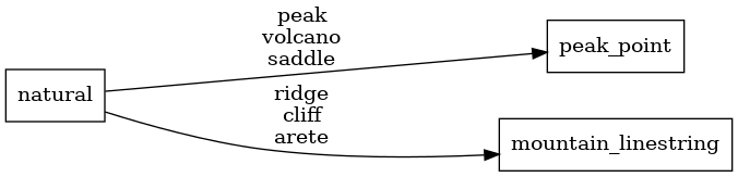
Mapping Diagram
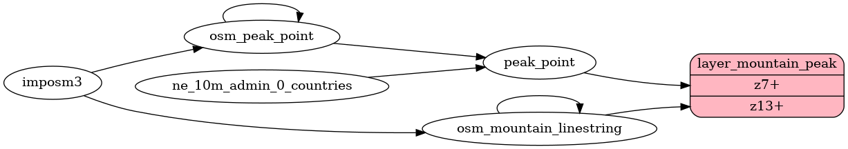
ETL diagram